
Geophysical Survey
1. 500 Meters LPS-500 3D Locators, For Water Detection
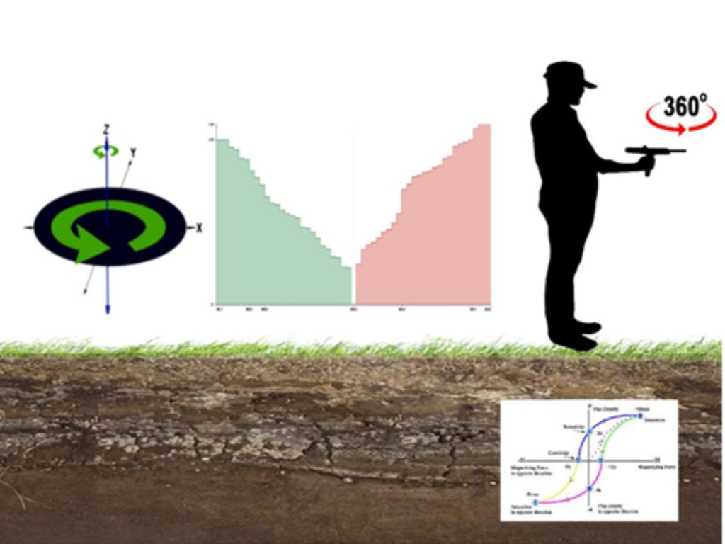
The long-range positioning system is powered with a long-range system and a host system which completely works on the geomagnetic sensing platform, the system senses the geomagnetic frequencies received from the ground and interprets the live data generated as per the range values in the host system.
APPLICATION:
- To analyse the permeability of the soil
- To map the depth of aquifer system
- To analyse the rock strength of an area
- To know quality, salinity of an particular area
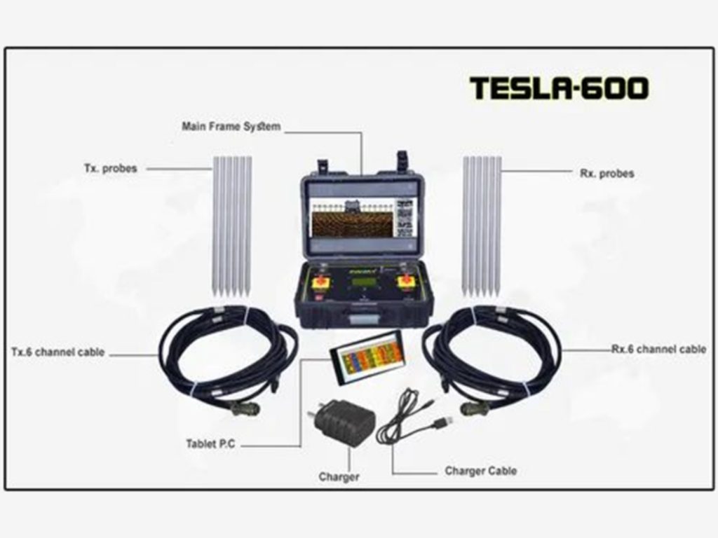
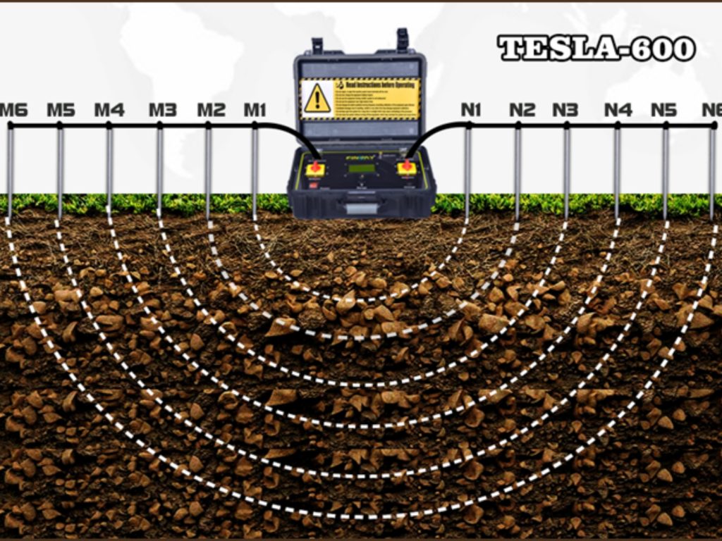
2. TESLA-600 GROUNDWATER DETECTOR:
TESLA 6 channel groundwater detector is designed on a frequency amplification sequence working on magnetotellurics 6 channel detection method. The system is powered for deeper depth penetration and noise reduction by utilizing the effect of different channels in order to decrease the noise data’s which may affect the actual results in a groundwater survey. The system is powered to penetrate and capture data’s to a depth of 600 meters in favorable geological conditions, power consumption of 0-5000 mv is inbuilt with an auto amplifier to support in cases where the penetration possibilities are poor and thus our equipment is ideal to suit any geological terrain in assessment of field data’s.
1. SSR-MP-ATS RESISTIVITY METER:
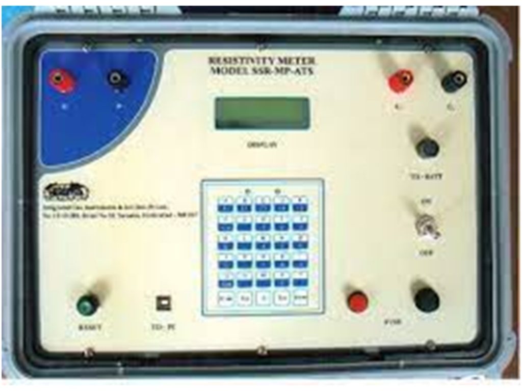
APPLICATION:
- Groundwater Exploration
- Bed Rock Investigations
- Delineation of Geological Structures
- Sand and Gravel Deposit Identification
- Mineral Investigations
- Geophysical Field Training